PocklingtonHistory.com
News
> The Sothebys
> Pocklington and the Sea
> Historical Horrors
> Allerthorpe Walk
> D-Day talk
> The 2024 AGM & Talk
> 18th Century Pocklington
> Two Short Talks
> Pocklington Heritage Festival (2023)
> Old Shops part 2
Events
> Pocklington District Heritage Trust
  14-16th Nov - **HERITAGE FESTIVAL**
  The Anglo-Saxons and Vikings'

> Pocklington District Heritage Trust
  14th Nov - 'Archaeology conference
  The Anglo-Saxons and Vikings'

> Pocklington District Heritage Trust
  15th Nov - 'Heritage Beanfeast
  A Viking evening with SHIFTIPIG'

> Pocklington Local History Group
  20th Mar 2025 - Early Cinema

Gallery
Market Place Market Place
Note the new building in the photo on the corner.
Regent Street Regent Street
Note the 'Old Red Lion Hotel'
Chapmangate Chapmangate
Note the independent chapel built in 1807 to the left.
Publications
Woldgate History Woldgate History

"A History of Woldgate School"

* 60 pages
* Fully illustrated
* Only £5.00
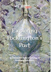
epp Exploring Pocklington's Past

* Peter Halkon
* Summary of
Pocklington Archaeology
* Only £5.00
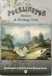
Heritage Trail Heritage Trail

"A Pock History & Heritage Trail"

* 2nd edition
* 27 pages
* Old photos
* Only £4.99

People and Places Thumb Old Pock

"People and Places of Old Pocklington"

* 40 pages
* Old photos
* Only £5.99
Adieu WW1 Book

"Adieu to dear old Pock"

  * ww1 diary
  * 53 profiles
  * Local News
  * 299 soldiers
  * 246 pages
Newsletter

PDLHG Newsletters
#1 Oct 2020
#2 Dec 2020
#3 May 2021

East Cottingwith Parish Enclosure 1774
This map has been created by John Nottingham to depict the subdivision of the outlying lands in the parish of East Cottingwith as allotted by the 1774 enclosure act, plus the various 'Close' (field) allotment owners listed in the table. An associated map for the inner village properties and landowners has also been produced.

To view the full-scale map, please click on the 'View fullscreen' link. Zoom into the map and scroll around as required to read the data.

On this East Cottingwith parish map, the solid yellow line depicts the parish boundary, although this has been modified on several occasions from 1774 to 1935. The line on the western boundary shows the position as at 1774, running approximately down the River Derwent, but allowing for the mud banks alongside the river. On the northern side, the parish boundary was adjusted shortly after the Pocklington Canal was opened in this area in 1816. The boundary line then ran parallel to and immediately to the north of the canal as far as the point where the canal turned north into the hamlet of Storwood (then part of Melbourne parish). On the eastern boundary, the line depicts the position prior to 1935 when, in that year, East Cottingwith and the adjacent hamlet of Storwood (Storthwaite) were combined to form the present civil parish of Cottingwith, and the parish boundary modified accordingly.
View fullscreen