 |
|
|
|
|
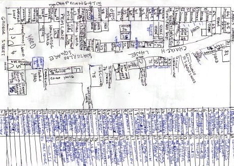
| 1940's map of Chapmangate South |
|
This map is of Chapmangate South and Church Lane was drawn by a Pocklington resident, completely from his own recollections of living in the town all of his life. Since drawing the map, he remembered that co-op house number 67 was Mrs Kell.
n.b. To Zoom in to the map, hover over it with the mouse cursor, it may take a few seconds to load depending on the speed of your connection and will appear below if you have Flash installed in your browser. |
|
|
|


