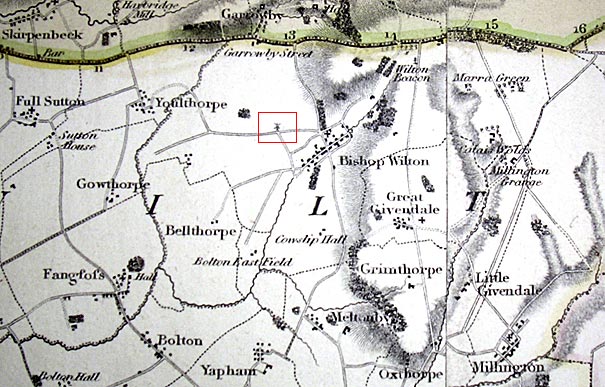
Greenwood's Map of Yorkshire

This is a portion of a map from 1817. One interesting feature is boxed in red - a windmill at the junction of Thorny Lane with Bray Gate.
Beware, it is possible that there are one or two inaccuracies in the map. The farm that is currently known as Wilton Lodge is shown as Cowslip Hall although directories for the 1800s have it as Cowslip Hill. Perhaps "Hall" was swapped with "Hill". The two wooded areas, one along the lane to Garrowby Hill and one along Mucky Lane were probably avenues of trees rather than whole plots.
The map was surveyed by C. Greenwood between 1815 to 1817 and published by Robinson & Son of Wakefield in 1817.
(c) Copyright 2009 Contributors. All rights reserved. |